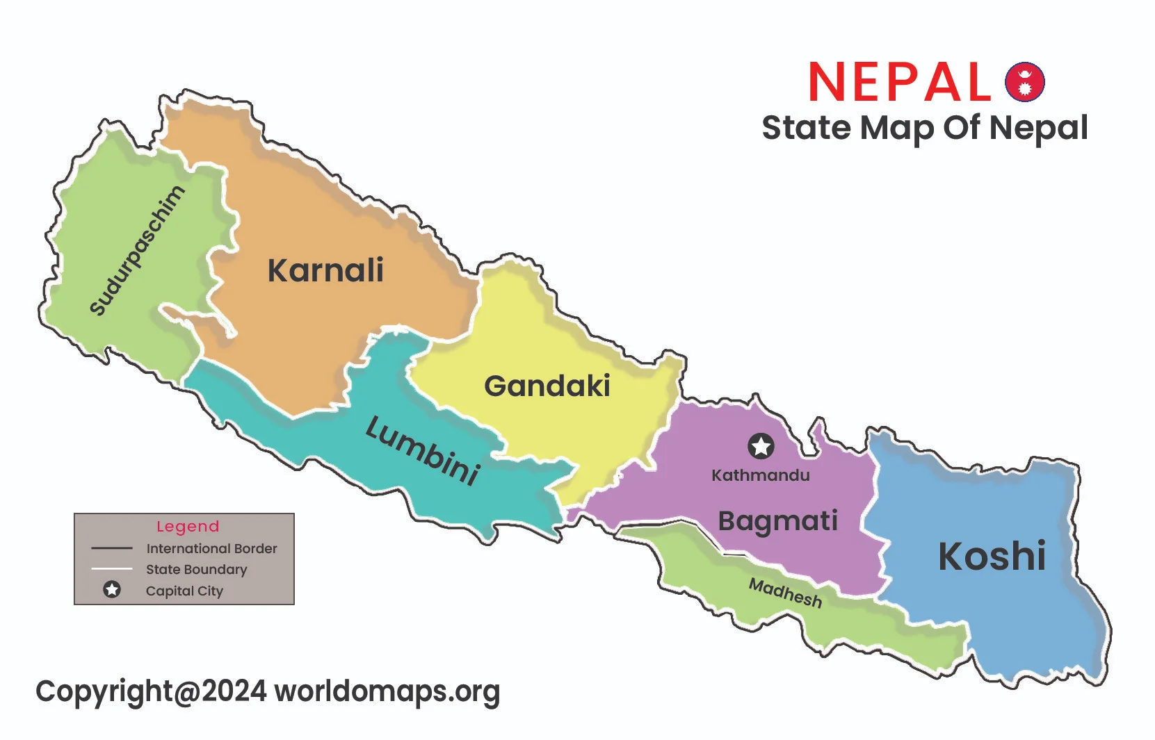
State Map of Nepal

State Map of Nepal Nepal, a landlocked country in South Asia, is divided into seven provinces, each with its own unique geographical, cultural, and economic characteristics. The country’s administrative divisions were restructured after the implementation of its new constitution in 2015, transitioning from a unitary system to a federal one. This division enhances local governance […]
State Map of Afghanistan

State Map of Afghanistan state map of Afghanistan Afghanistan, a landlocked and mountainous country, is administratively divided into 34 provinces (Wilayat), each representing unique geographical and cultural regions. The provinces are further subdivided into districts, towns, and villages, highlighting the country’s diverse landscape and population. The capital city, Kabul, serves as the political heart of […]
State Map of India

State Map of India State Map of India India, a vast and diverse country, is divided into 28 states and 8 Union Territories, each with its own unique cultural, historical, and geographical identity. The states are further divided into districts and towns, reflecting the country’s rich diversity and administrative structure. India’s state boundaries were mostly […]
