State (Governorates/Muhafazat) Map of Lebanon
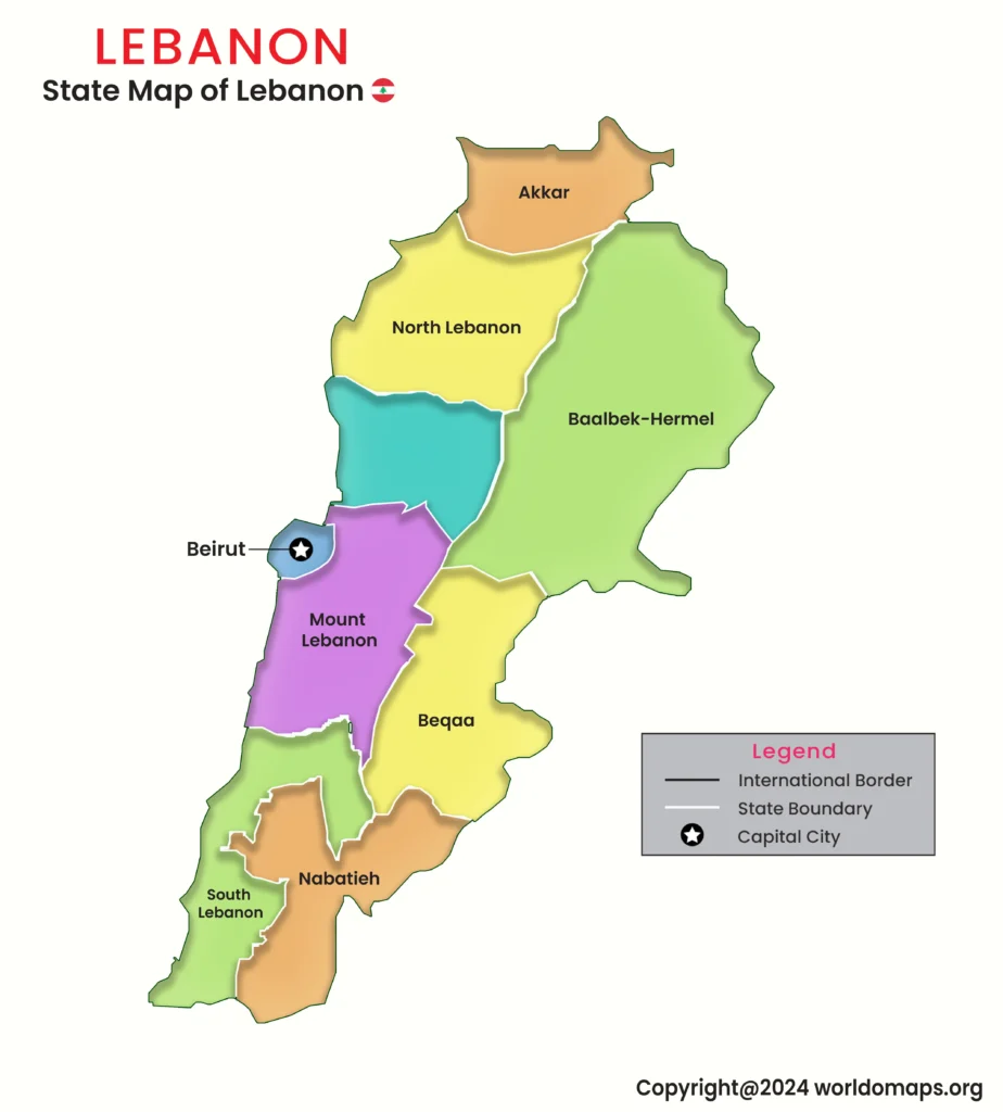
Lebanon, a small yet historically and culturally rich country in the Middle East, is divided into 8 governorates (muhafazat). Each governorate plays a crucial role in Lebanon’s political, economic, and social landscape. The capital city, Beirut, is the nation’s cultural and financial hub, known for its vibrant history and Mediterranean coastline. Lebanon’s diverse terrain includes coastal plains, mountain ranges, and fertile valleys, making it a unique and strategically important country in the region.
Major Governorates and Regional Significance:
- Beirut Governorate: The smallest yet most populous region, housing Lebanon’s capital and financial center.
- Mount Lebanon Governorate: A key economic and residential area with historic and touristic significance.
- North Governorate: Known for its port city, Tripoli, and its rich cultural heritage.
- South Governorate: Features important coastal cities such as Sidon and Tyre, known for trade and tourism.
- Bekaa Governorate: A major agricultural hub with the fertile Bekaa Valley.
- Nabatieh Governorate: Rich in history and home to various cultural and religious sites.
List of Lebanon’s Governorates with Capitals, Areas, and Major Cities
This table provides an overview of Lebanon’s 8 governorates, including their capitals, area, and major cities.
| No. | Governorate | Capital City | Area (sq. km) | Code | Major Cities |
|---|---|---|---|---|---|
|
1. |
Beirut |
Beirut |
19 |
BE |
Beirut |
|
2. |
Mount Lebanon |
Baabda |
1,968 |
ML |
Jounieh, Aley |
|
3. |
North |
Tripoli |
2,024 |
NO |
Batroun, Zgharta |
|
4. |
Akkar |
Halba |
788 |
AK |
Kobayat, Qoubaiyat |
|
5. |
South |
Sidon |
1,226 |
SO |
Tyre, Jezzine |
|
6. |
Nabatieh |
Nabatieh |
1,058 |
NA |
Bint Jbeil, Marjayoun |
|
7. |
Bekaa |
Zahle |
4,429 |
BK |
Baalbek, Chtaura |
|
8. |
Baalbek-Hermel |
Baalbek |
3,009 |
BH |
Hermel, Ras Baalbek |
Lebanon’s governorates highlight the country’s rich cultural heritage, economic centers, and diverse landscapes, making it a key part of the Levant region.