Stg Site World Map

Category: Asia

Map of Asia and it’s Countries

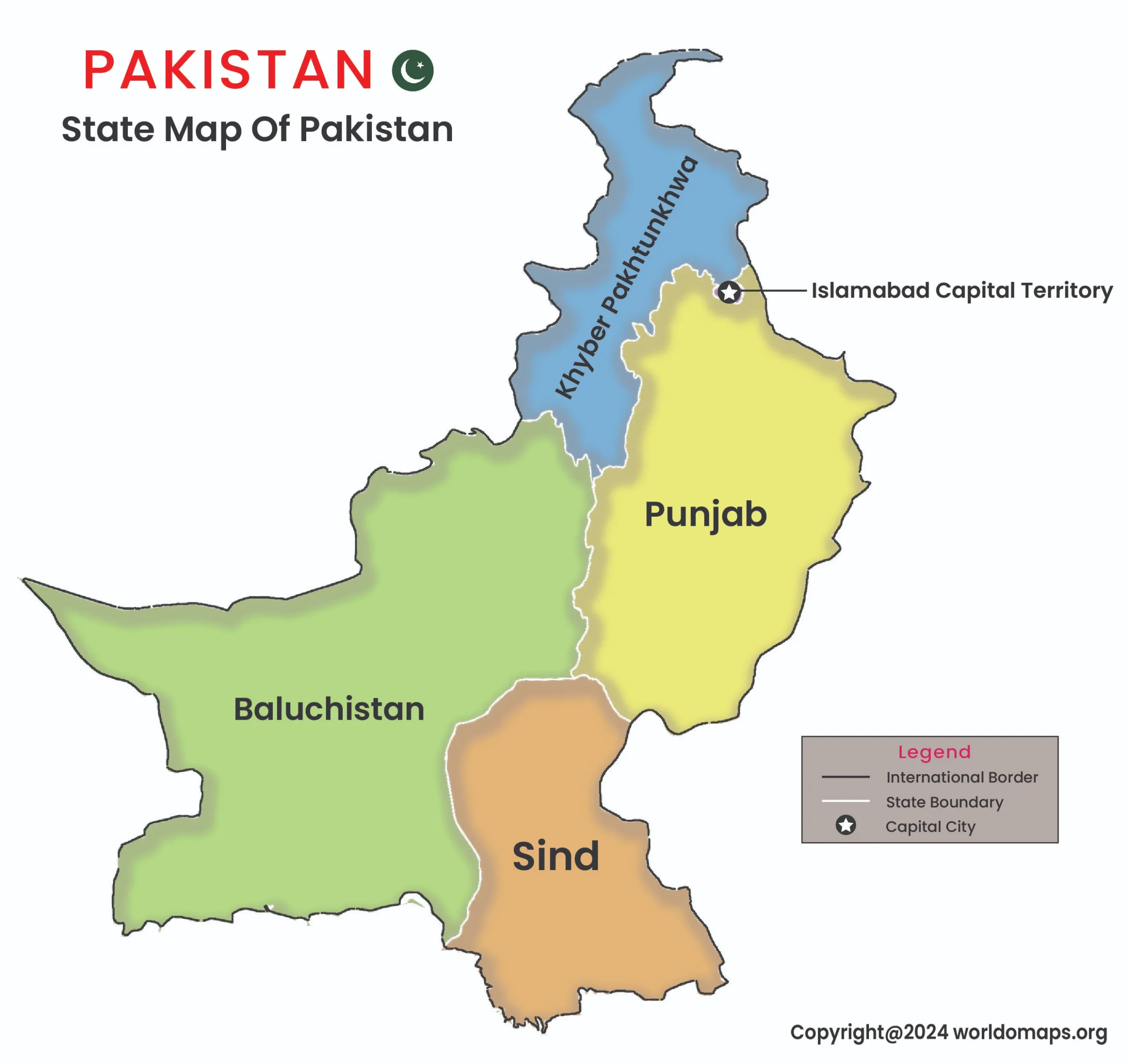
state map of Pakistan

State Map of Pakistan

State Map of Pakistan State Map of Pakistan Pakistan is a diverse South Asian country, administratively divided into four provinces, two autonomous territories, and the federal territory of Islamabad. Each region represents unique cultural and geographical features, from the bustling cities to the scenic mountain

Visit Now
state map of bangladesh

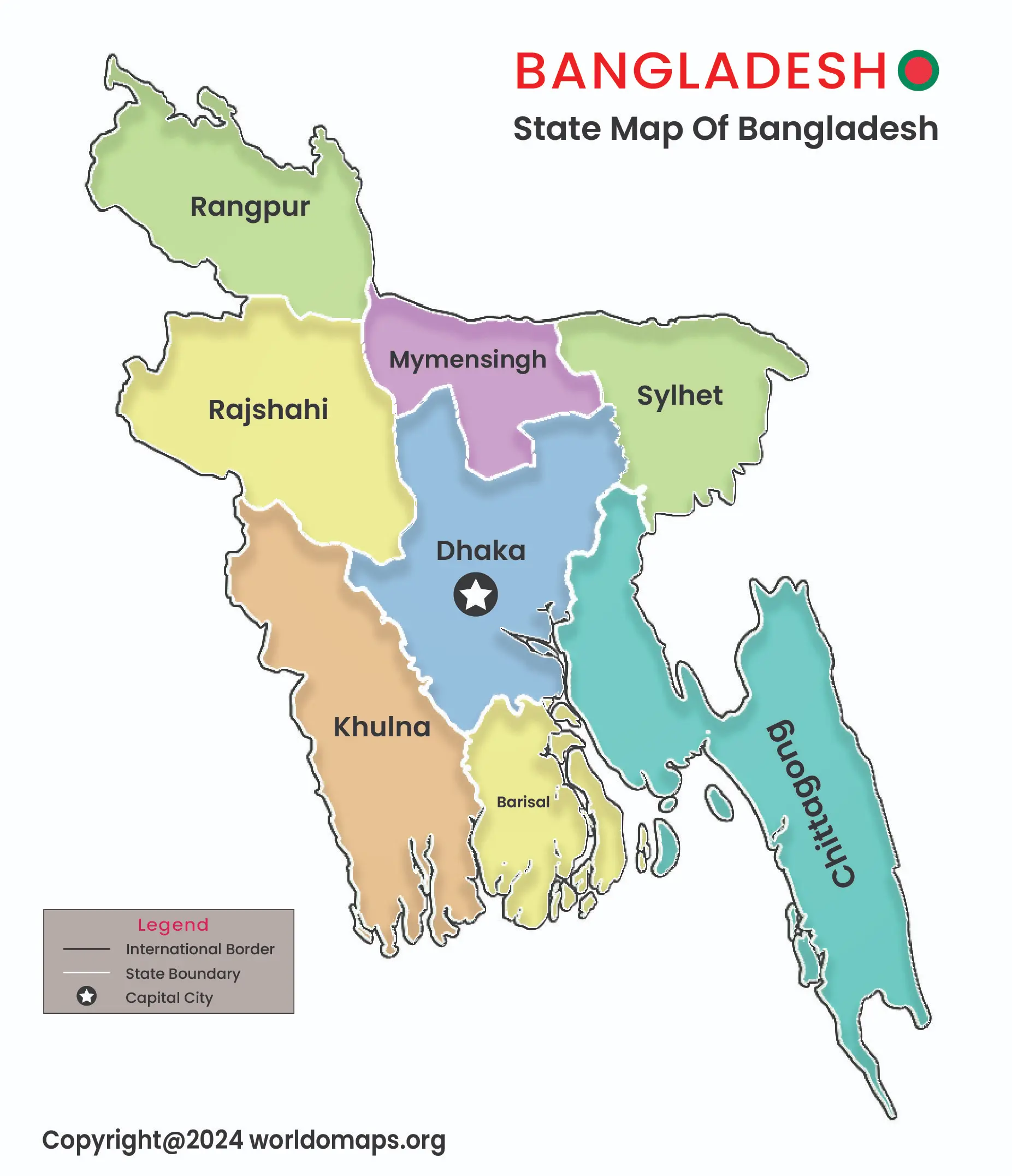
State Map of Bangladesh

State Map of Bangladesh State Map of Bangladesh Bangladesh is divided into 8 administrative divisions, each named after its respective capital city. These divisions are further subdivided into districts, upazilas (sub-districts), and unions. The country’s political landscape is shaped by its parliamentary democracy, with Dhaka

Visit Now
state map of Bhutan

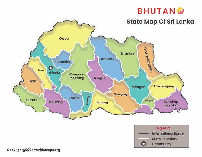
State Map of Bhutan

State Map of Bhutan Bhutan, a small, landlocked Himalayan kingdom, is divided into 20 districts (Dzongkhags), each showcasing distinct cultural and geographical traits. The districts are further divided into smaller administrative units known as gewogs (blocks), villages, and towns, emphasizing Bhutan’s unique landscapes and rich

Visit Now
state map of russia

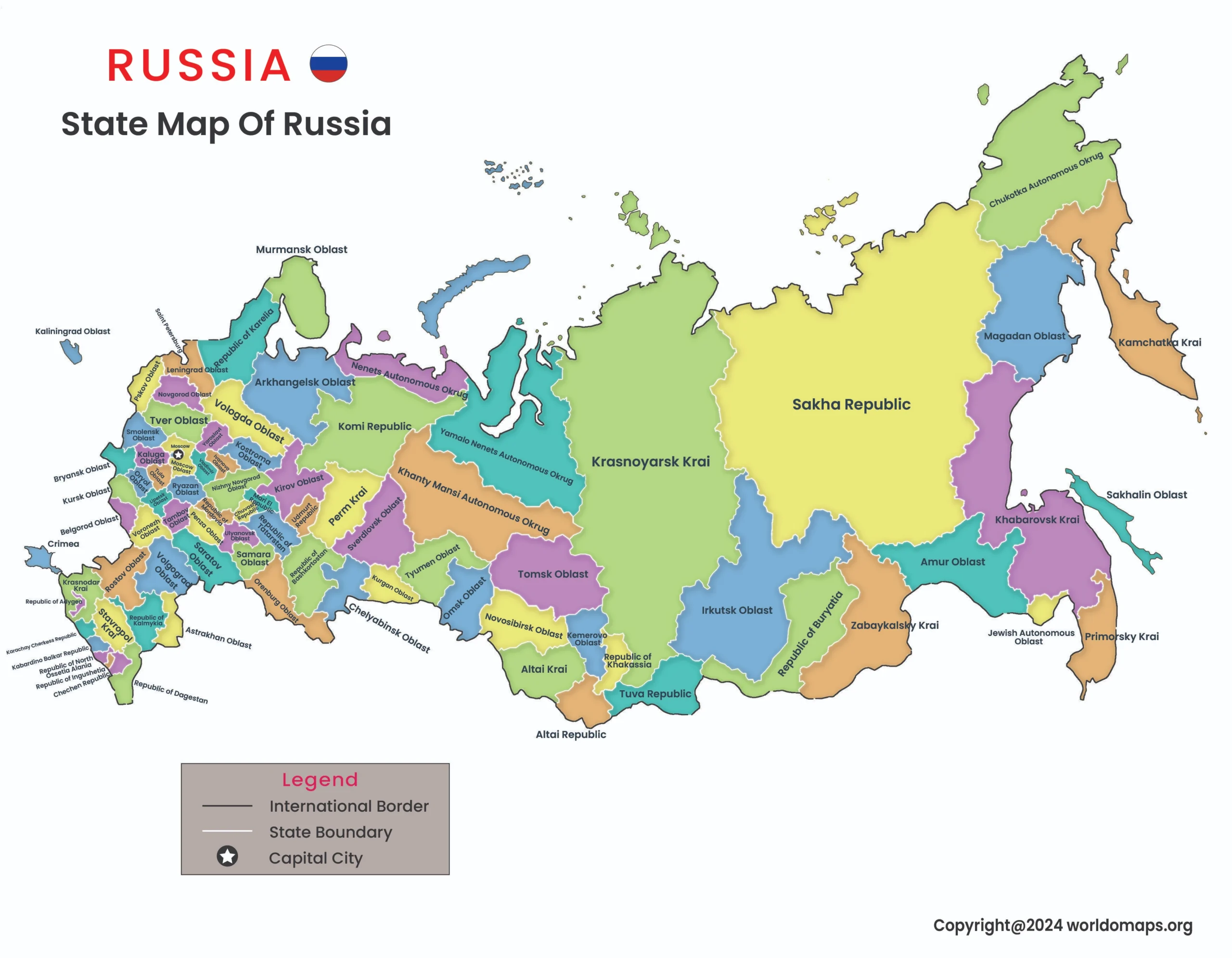
State Map of Russia

State Map of Russia State Map of Russia Russia, the world’s largest country, is administratively divided into several types of federal subjects that represent its vast territorial expanse and diverse cultures. The country consists of 85 federal subjects, including republics, krais (territories), oblasts (regions), federal

Visit Now
State Map of Nepal

State Map of Nepal

State Map of Nepal Nepal, a landlocked country in South Asia, is divided into seven provinces, each with its own unique geographical, cultural, and economic characteristics. The country’s administrative divisions were restructured after the implementation of its new constitution in 2015, transitioning from a unitary

Visit Now
state map of Afghanistan

State Map of Afghanistan

State Map of Afghanistan state map of Afghanistan Afghanistan, a landlocked and mountainous country, is administratively divided into 34 provinces (Wilayat), each representing unique geographical and cultural regions. The provinces are further subdivided into districts, towns, and villages, highlighting the country’s diverse landscape and population.

Visit Now
State Map of India

State Map of India

State Map of India State Map of India India, a vast and diverse country, is divided into 28 states and 8 Union Territories, each with its own unique cultural, historical, and geographical identity. The states are further divided into districts and towns, reflecting the country’s

Visit Now